Landowner Weed Mapping Tools

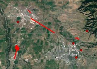
Weed mapping is an important part of developing a weed management plan. Weed maps provide a picture of where the weeds are located, can help you understand the magnitude of your weed problem, and are useful for planning and documenting weed control activities. There are a number of tools that can be used to create digital weed maps on your phone or computer. Digital maps will precisely show the location of an infestation, measure acreages, and provide other important information to aid in the planning process.
Here is a brief overview of some of the weed mapping tools currently available. This overview is not an endorsement of any product, but is instead a list of applications that we have found to be useful for mapping weeds. Please let us know if there is another great tool out there that we are missing!
onX Hunt and GAIA GPS
What they are good for:
- Mapping weeds in the field using your phone and saving maps for later use
- Very simple and easy weed mapping - all the resources for creating basic maps are provided within the software applications
What you can do with them:
- View a satellite image of where you are and see property boundaries and owner information
- Drop waypoints and label them to mark weed locations
- Draw lines and polygons to mark and measure weed infestations, or use the ‘tracking’ feature to walk and record a path around an infestation
- View maps and navigate to weed locations when offline
- Easily share weed locations with other software users. Capture screenshots of your maps to share images with those that do not use the software
- Login to your account on your computer. From there you can export the weed maps you created using the phone app. Maps are exported as ‘KML’ files, which are a type of geographic file that can be viewed in other applications (e.g. GIS or GPS). You can also import KML files of weed maps that were created in other applications for viewing in the software
Cost: Annual subscription fee
Where to get them:
How to use them:
- onX Hunt - YouTube - Scroll to ‘Product Resources’ for tutorials
- Get Started – onX
- Gaia GPS - YouTube
- Videos and Tutorials – Gaia GPS
Google Earth
What it’s good for:
- Mapping weeds on your computer and then finding those locations in the field using your phone
- Creating complex maps that can be exported and shared
- Creating weed maps from data collected using a GPS unit
What you can do with it:
- Access Google Earth three ways: get the mobile app, use your computer’s browser interface, or download the desktop software
- Use the phone app to either drop waypoints and obtain lat/long locations of weeds, or draw polygons around infestations to measure area. You can save a screenshot image, but the features cannot be saved on your phone for future viewing
- Use the Google Earth browser interface on your computer to create weed maps for future use:
- Drop waypoints and draw lines and polygons to mark weed locations
- Label and measure infestations
- Export maps as KML files that can be used with other software (e.g. GIS or GPS)
- Save your maps to your Google account
- Use the Google Earth phone app to view the maps you made on your computer. You can use your phone to view those maps in the field and navigate to weed infestations
- Display property boundaries or other features on your weed maps. However, those KML files must first be downloaded from other sources and then loaded into Google Earth
- Import data collected with a GPS unit, including waypoints, tracks and routes that mark weed locations. These files can be imported into the browser or desktop version
- Use the desktop version for creating more sophisticated weed maps by adding more map layers and details.
Cost: Free
Where to get it: Google Earth
How to use it:
- Google Earth - YouTube – Scroll to ‘Google Earth Creation Tools’ for tutorials
- Google Earth Help
EDDMapS – Early Detection and Distribution Mapping System
What it’s good for:
- Contributing information about weed distribution to a regional database of weed observations
- Reporting weed infestations to provide information for management
- Notifying land managers of new weed invaders to help with Early Detection Rapid Response efforts
What you can do with it:
- Use the built-in field guide to identify noxious weeds in the field
- Drop points or draw polygons to mark weed locations in the field on your phone
- Record information about the infestation, such as species and size of the area infested
- Revisit the infestation in the future to provide updates
- Upload records while in the field. Alternatively, use the app offline and upload the records later. All uploaded records are verified by a weed expert before being released to the database
- Once verified, view your weed infestations on distribution maps in the app. Your weed maps can be viewed by anyone using the app
- Report weed sightings as a part of the ‘Wild Spotter’ program, a spinoff of EDDMapS. Wild Spotter focuses on mapping weeds in wild places. The Wild Spotter program uses a different app that functions much like EDDMapS and reports to the same database
Cost: Free
Where to get it:
How to use it:
- EDDMapS Training Materials – Scroll to ‘EDDMaps App Walk-Through’
- Wild Spotter - YouTube

